Before You Buy Waterfront on Monona, Waubesa, or Kegonsa: What the Frontage Number Doesn't Include
September 24, 2026
September 24, 2026
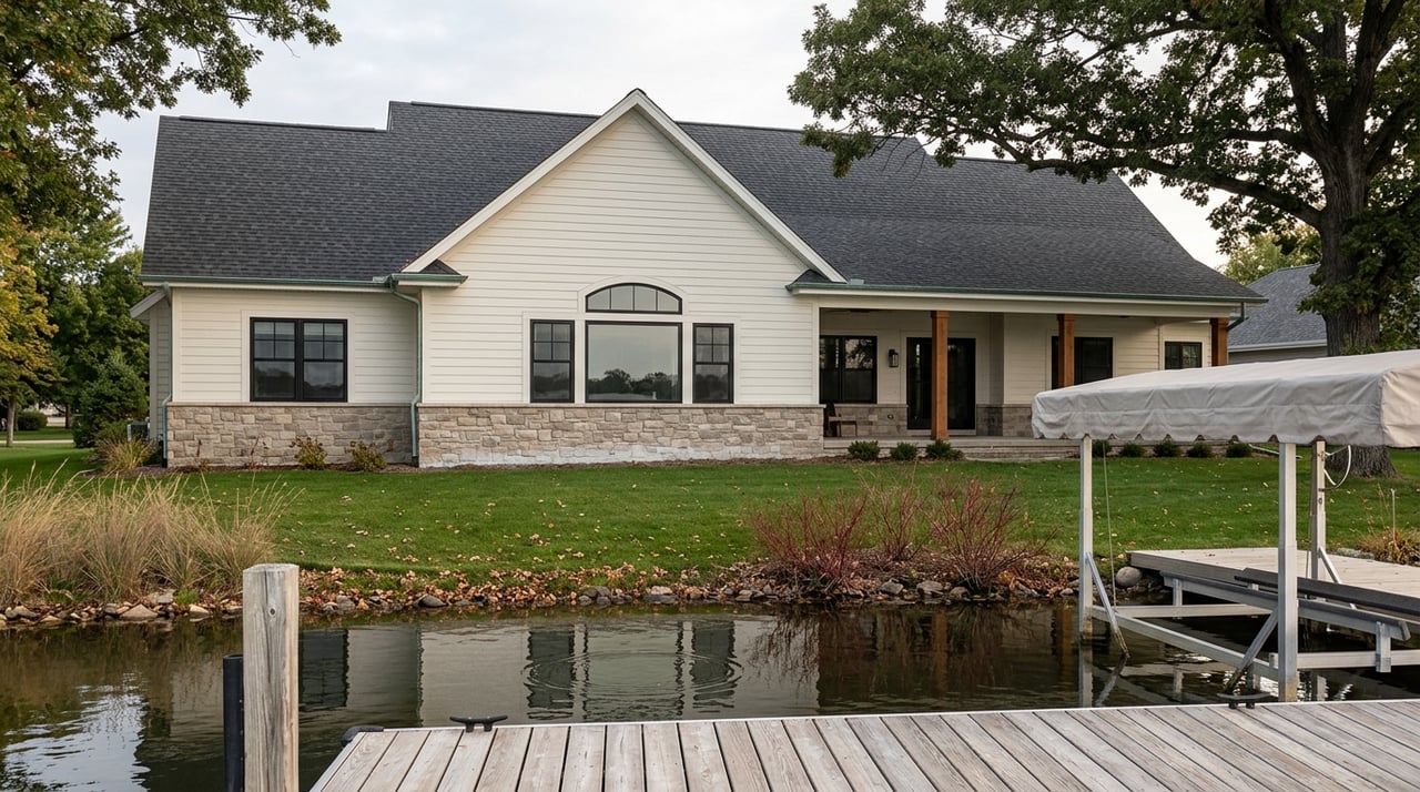
A home inspector will crawl your attic, test your outlets, and flag a hairline crack in the foundation. What an inspector will not do, on any of the three lakes at the south end of the Yahara chain, is tell you whether the pier sitting at the end of your new backyard is legal, whether your neighbor agrees on where your water actually starts, or whether the dock you just watched a seller demonstrate for you is grandfathered, permitted, or quietly out of compliance. Those questions live outside a standard inspection, and on Lake Monona, Lake Waubesa, and Lake Kegonsa, they are exactly the questions that surface after closing, not before it.
Listings on these lakes love a frontage number. You'll see 50 feet of level shoreline on a Kegonsa listing, 60 feet on a Waubesa chalet, 77 feet where a Monona property meets the mouth of the Yahara River. That number is real. It's also only describing where your property line touches the shore. It says nothing about how much water you're entitled to use in front of it, who else has a say in that zone, or whether the structure already sitting there was ever built to code. Buyers who treat frontage footage as the whole picture are the ones who end up in a dispute with a neighbor two summers later, or discover their new dock needs to come out entirely.
Wisconsin's Department of Natural Resources publishes a Pier Planner that spells out, in real detail, what a waterfront owner can build without an individual permit. The rules are specific enough to actually plan around: a pier, dock, or wharf can't exceed 6 feet in width, and the number of boat slips is tied directly to shoreline footage, two slips for the first 50 feet of frontage and one more for every additional full 50 feet, with the same formula applied to personal watercraft. A seasonal boat shelter, the kind with a roof but no walls, stays exempt from permitting only if it's removed from the water every year between December 1 and April 1.
There's also a grandfather clause that matters more than it looks. Structures placed in the water before April 17, 2012 are exempt from today's permitting standards even if they don't meet current dimensions, as long as they don't interfere with another riparian owner's rights and the DNR never previously flagged them. That's a meaningful protection for older piers on Waubesa and Kegonsa in particular, where longer ownership tenures are common. It's also a trap for a buyer who assumes a dock's age automatically makes it fine. Grandfathering is conditional, not automatic, and the condition that voids it is the one the state has the least interest in settling.
Here's the part that catches people off guard during an actual transaction. The DNR is explicit that it does not get involved in private riparian zone disputes between neighbors. If you and the person next door disagree about where your water rights end and theirs begin, the agency's own guidance is to work it out through negotiation, and if that fails, through a judge. There is no state inspector who shows up to draw the line. State statutes don't even mandate a single method for determining a riparian zone. Multiple methods exist, and the DNR's own planning documents include worked examples showing why the same shoreline can produce different boundary interpretations depending on which method a surveyor uses.
That means the riparian zone underneath a waterfront listing on Monona, Waubesa, or Kegonsa is a matter of local agreement, not settled record. If the current owner has a longstanding informal understanding with the neighbor about where docks go, you're buying that informal understanding along with the house. If they don't, you may be buying a boundary that's never actually been tested.
The three lakes get lumped together in listings and in local shorthand, but they don't behave the same way, and that difference shapes what a frontage number is actually worth on each one.
| Lake Monona | Lake Waubesa | Lake Kegonsa | |
|---|---|---|---|
| Character | Deep lake, urban shoreline close to downtown Madison and the isthmus | Shallower drainage lake with faster water turnover, more paddling and wetlands access | Shallower drainage lake, roughly 3,200 acres, farthest south and east of the four major lakes |
| Distance from downtown | Closest of the three | Sits in the middle | Longest commute of the four, generally |
| Notable feature | Public parks and downtown-adjacent shoreline | Highest nearshore water clarity of the five Yahara lakes in 2024 monitoring, per Clean Lakes Alliance | Near the Stoughton area, with listings referencing proximity to Stoughton Country Club |
The water quality note on Waubesa deserves a second look because it's counterintuitive. Clean Lakes Alliance monitoring found no significant cyanobacteria blooms on Waubesa from June through August 2025, and 2024 nearshore readings showed the clearest water of any lake in the chain. At the same time, Clean Lakes Alliance points out that much of the phosphorus reaching Waubesa arrives from upstream, largely through Monona. The lakes function as one connected system. A clean summer on Waubesa isn't independent of what happens upstream, which is worth knowing if water clarity is part of why you're buying there.
Boaters moving between the lakes also pass through the Babcock Lock at McFarland, one more sign that these three bodies of water are a linked chain rather than three separate markets that happen to share a county.
If you're the one listing waterfront property on any of these three lakes, the pier question works in your favor when you get ahead of it. A seller who can say when the dock was installed, whether it was ever flagged by the DNR, and whether the neighbor relationship around the riparian line has ever been contested removes exactly the uncertainty that makes a cautious buyer hesitate or renegotiate. Dane County's Land and Water Resources Department assigns every lakeshore property on Mendota, Monona, Waubesa, and Kegonsa a unique lake address for emergency response, cross-referenced with the street address in the 911 system. Owners can request a reflective sign to post at the end of their pier. It's a small detail, but pointing to a documented, county-recognized address for the dock is one more way to demonstrate the structure is known, mapped, and uncontested rather than informal.
Do I need a permit for a normal residential dock on these lakes? Most seasonal piers that meet the DNR's size and slip standards are exempt from an individual permit. Anything wider than 6 feet, permanently installed, or exceeding the slip formula for your frontage typically needs one.
Can the DNR settle a boundary disagreement with my neighbor? No. The agency's own guidance directs neighbors to negotiate directly, with a judge as the only entity that can enforce private riparian rights if negotiation fails.
Does a grandfathered pier ever lose its exempt status? Yes, if it starts interfering with another riparian owner's rights or the DNR had already notified the owner that the structure was a problem before the sale.
Waterfront transactions on this stretch of the Yahara chain move fast in the right season, and the pier is usually the last thing anyone stops to interrogate. It shouldn't be. If you're buying or selling on Monona, Waubesa, or Kegonsa and want someone who will ask these questions before you're under contract instead of after, Madison Real Estate Team offers a free neighborhood consultation built around exactly this kind of local detail.
Stay up to date on the latest real estate trends.


Get assistance in determining current property value, crafting a competitive offer, writing and negotiating a contract, and much more. Contact us today.